
Electromagnetic spectrum operations explained: EMSO, JEMSO, and EMBM
How DoD runs electromagnetic spectrum operations: JP 3-85, the EMS superiority strategy, JEMSO cells, EMBM, service EW units, and GAO's...
For most of the last thirty years, the military answer to "where am I, which way am I going, and what time is it" has been the same: GPS. It is accurate, free at the point of use, global, and baked into almost every weapon, vehicle, radio, and network the Department of Defense owns. That ubiquity is also the problem. GPS signals arrive at the earth's surface at very low power from satellites in medium earth orbit, and any force that relies on a single low-power signal for position and timing has handed an adversary an obvious target for electromagnetic attack.
The department has known this for a long time. The response has two halves. The first is to harden GPS itself through new satellites, a new ground control segment, and military code (M-code) user equipment. The second is to stop treating GPS as the only source of truth and build user equipment that fuses GPS with inertial sensors, clocks, terrestrial and space-based signals, and onboard sensing of the environment. Together these are usually grouped under the label assured positioning, navigation, and timing, or A-PNT.
This article walks through both halves using public sources: what A-PNT means in DoD usage, where GPS modernization actually stands according to GAO and DOT&E, what the Army and other services have fielded, which alternative sources are real and which are still in the lab, why integration is the hard part, and what program offices should be watching over the next few years.
Assured PNT is not a single system. It is a property of a system or a force. A commonly cited DoD definition, quoted in a 2021 Defense Systems Information Analysis Center (DSIAC) technical inquiry report on A-PNT, describes it as the ability to provide operational forces continuous access to position, velocity, attitude, and time information with confirmed integrity and sufficient accuracy to perform the mission under the complete range of threat conditions. The threat conditions in that framing explicitly include GPS degradation, denial, and deception.
Several words in that definition carry most of the weight:
In practice, the services describe A-PNT as a layered approach. GPS, preferably M-code, remains the primary source when it is available. Around it sit protected antennas and receivers that can detect and reject interference, inertial measurement units and odometry that carry the solution through outages, stable clocks that hold time, and alternative sources that provide independent absolute fixes. A fusion engine weighs all of them, flags when one source disagrees with the others, and tells the operator how much to trust the answer.
GAO's 2021 technology assessment on defense navigation capabilities, which surveyed the department's work on complements to GPS, sorted alternatives into two broad families. Relative PNT sources, such as inertial sensors and clocks, measure change from a known starting point and drift over time. Absolute PNT sources, such as celestial, magnetic, very low frequency radio, and low earth orbit (LEO) satellite signals, provide independent fixes that can bound that drift. GAO concluded that no single alternative can replace GPS across all military applications, which is the basic logic behind layering.
Before looking at alternatives, it helps to be clear about the status of GPS modernization, because many A-PNT plans assume M-code is available and fielded. The public record shows steady but slow progress across all three segments of the system.
M-code is not new on orbit. GAO reported in September 2024 (GAO-24-106841) that the first M-code capable satellite launched in 2005, and that as of May 2024, 24 of 31 satellites in the operational constellation were M-code capable. The Space Force's stated goal, per GAO, is to keep 24 M-code capable satellites in continuous operation through the 2030s, and GAO warned that the service risks missing that goal because of delays in follow-on satellites.
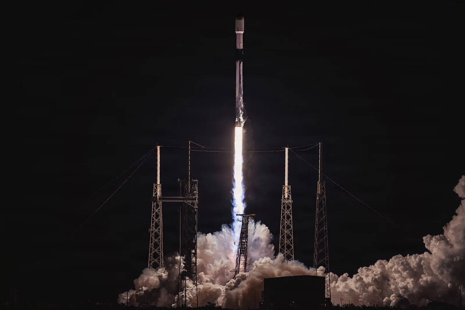
The GPS III satellites built by Lockheed Martin have been launching steadily. GPS III SV-08 launched on May 30, 2025, on an accelerated schedule, leaving two GPS III satellites remaining at that time according to GPS World reporting. The follow-on GPS IIIF satellites add capabilities, including a regional military protection signal intended to deliver higher-power M-code into a theater of operations. GAO reported in 2024 that technical and manufacturing challenges, including problems with traveling wave tube amplifiers, had pushed the planned first GPS IIIF launch later. DOT&E's FY2025 annual report lists the first GPS IIIF launch for FY2027 with operational acceptance in FY2028.
The Next Generation Operational Control System (OCX), built by RTX, is the ground system needed to command the modernized constellation and enable full M-code operations. It is one of the department's most troubled software programs. GAO's 2024 report described continuing deficiencies found in qualification testing and an operational acceptance date that had moved to December 2025. Breaking Defense reported in July 2025 that RTX delivered OCX Blocks 1 and 2 to the Space Force on July 1, 2025, that total projected program cost was about $10 billion, and that the program was more than $3 billion over budget.
Delivery is not the same as operational use. DOT&E's FY2025 report states that the Space Force accepted OCX from the contractor in July 2025, that operational testing began with a cooperative vulnerability and penetration assessment in September 2025, and that a constellation transfer from the legacy control system is planned in FY2026 with operational acceptance to follow. DOT&E also stated that there were insufficient data at that time to assess OCX's operational effectiveness and suitability, and that continued OCX delays put U.S. warfighters and allies at risk because full M-code capability has not yet been operationally deployed.
The user segment is where most warfighters feel the delay. The Military GPS User Equipment (MGUE) program develops the M-code receiver cards and application specific integrated circuits (ASICs) that the services then integrate into their own platforms.
Service-level integration varies. In the same 2024 report, GAO found the Army on track for M-code fielding in its ground systems, the Navy relying on Air Force receivers for many platforms and planning maritime receiver testing in 2025, and the Air Force's receiver efforts significantly delayed, including the end of one embedded GPS/INS contract in March 2024 after the vendor could not provide an executable schedule.
The practical takeaway is that M-code is real, it is on orbit, and receivers are reaching units, but the full end-to-end capability that depends on OCX and broad receiver fielding has been arriving years later than planned. A-PNT programs that assume ubiquitous M-code by a specific date should carry that as a risk.
The Space Force has also pursued a smaller, cheaper augmentation constellation called Resilient GPS (R-GPS). As publicly reported in early 2025, the effort awarded initial design contracts to four companies in 2024, later narrowed to three, with a goal of launching a first set of satellites around 2028 and a projected cost of roughly $1 billion over five years. The House Appropriations defense subcommittee rejected a $77 million FY2025 funding realignment for the effort in June 2024, writing that it was not clear how the additional satellites increase resilience against the primary jamming threat to GPS, and pointing to the M-code user equipment shortfall. The program's future depends on later budget decisions that are still playing out, so it is worth tracking but not counting on.
The Army has gone further than any other service in fielding dedicated A-PNT systems as programs of record. The work sits in Project Manager Positioning, Navigation, and Timing (PM PNT) under Program Executive Office Intelligence, Electronic Warfare, and Sensors, with strategy and roadmaps coordinated through what is now the All-Domain Sensing Cross-Functional Team.
MAPS Gen I was first fielded in 2019 as an interim capability to protect vehicle GPS from jamming. MAPS Gen II is the long-term system. Public Army descriptions list M-code, sensor fusion with alternative sources, and an improved exterior antenna with anti-jam and anti-spoofing capabilities, packaged so that a single system can replace both MAPS Gen I and several legacy Defense Advanced GPS Receivers on a vehicle. Inside GNSS reported in 2025 that the system uses a seven-element anti-jam antenna and is intended for vehicles, watercraft, and munition systems.
The Army approved full-rate production of MAPS Gen II in early 2025, under a Collins Aerospace contract first awarded in September 2022 and reported at $583 million over five years. An Army.mil article from September 2025 described fielding underway, including to the 2nd Stryker Brigade Combat Team, 2nd Infantry Division, and quoted the program office describing the system's ability to detect and reject GPS interference and notify the soldier that it is operating in an electromagnetic warfare environment.
DAPS Gen II is the handheld equivalent: an M-code receiver that fuses multiple PNT sources and works standalone, with a wrist-worn display, or with the Nett Warrior end user device. DOT&E's FY2024 report describes initial operational testing at Fort Huachuca in November 2023, full-rate production approval in August 2024, and a target of initial operational capability in March 2025. DOT&E assessed DAPS Gen II as operationally effective, while noting decreased position and notification accuracy under very challenging threat environments, and found it operationally suitable with 99 percent operational availability during testing.
An Army.mil article from May 2025 reported that in FY2024 the Army fielded about 27,000 M-code capable receivers, more than 2,500 ground A-PNT systems, roughly 7,000 M-code precision guidance kits for artillery, and 46 M-code aviation navigation systems on Black Hawk helicopters. That is significant, but still a fraction of the legacy receiver base.
Army program officials have publicly described the approach as layering: inertial measurement units, wheel speed odometry, chip-scale atomic clocks, multi-constellation reception, M-code, and hardened alternative navigation (ALTNAV) signals, all combined in a fusion engine. Inside GNSS also reported in 2025 on a newer Army effort called NorthStar, described as a modular, open systems approach to lower-cost mounted PNT that can be upgraded as threats change.
The other services have taken different routes, often embedding A-PNT functions into platform navigation systems rather than standing up separate A-PNT programs.
The alternatives fall into a few groups: other space-based signals, terrestrial radio signals, self-contained sensors that measure the environment, and better clocks and inertial sensors. Each has a different maturity, a different failure mode, and a different integration burden.
Satellites in low earth orbit are roughly twenty to thirty times closer to the earth than GPS satellites, which means their signals can arrive much stronger and their geometry changes quickly, which helps some positioning techniques. Several efforts are relevant:
LEO PNT is not immune to electromagnetic attack. Stronger signals raise the bar for a jammer, but they do not remove the threat, and the receiving equipment still needs to be protected, integrated, and certified. It also creates dependence on commercial operators, which raises questions about service guarantees in conflict and how to write requirements against a service the government does not control.
Loran-C, a high-power, low-frequency terrestrial navigation system, operated in the United States for decades. The Coast Guard announced the decision to decommission it in January 2010, citing costs and redundancy with GPS. Enhanced Loran (eLoran), a modernized version with better timing and data channels, has been proposed repeatedly since then as a domestic GPS backup, particularly for timing.
As of the most recent public federal positions, the United States does not operate an eLoran service. The Department of Transportation has taken a technology-agnostic position. In a November 2023 letter responding to industry concerns, DOT stated that it believes there is a need for multiple and diverse PNT technologies for critical infrastructure, and that its October 2023 request for information on eLoran did not state a preference for eLoran. That RFI was tied to the Coast Guard's required divestiture of former Loran sites under the FY2023 National Defense Authorization Act, and sought information on federal assets that a commercial eLoran service would need.
For DoD, eLoran is relevant mainly as a homeland and critical infrastructure timing source, and as an example of a terrestrial, high-power signal that is hard to jam over wide areas. It is not a deployable battlefield navigation aid in its traditional form, because transmitters are large, fixed, and would be targets.
Beyond Loran, several terrestrial approaches exist:
DOT's complementary PNT work is the best public picture of how these perform. The 2023 action plan summarized earlier demonstrations of 11 technologies, including two LEO systems, two fiber timing systems, a system combining map matching, inertial sensing, and ultra-wideband, and six terrestrial radio frequency systems. A follow-on rapid phase awarded more than $7 million to nine vendors in June 2024 for field testing. According to DOT's Volpe Center, that testing concluded in June 2025 and results were briefed at an interagency workshop in August 2025.
Celestial navigation measures the angles to stars and other bodies and, with an accurate clock and vertical reference, computes position. It is passive, emits nothing, and cannot be jammed in the usual sense. Astro-inertial systems have flown on strategic aircraft and missiles for decades.
The limits are well understood. Daytime star tracking and cloud cover are hard problems for small, low-cost sensors near the ground. Accuracy depends on knowing the local vertical, which is difficult on a moving vehicle. Celestial works best on aircraft at altitude, ships, and spacecraft, and is far less useful for a soldier under tree cover. GAO listed it in 2021 among the absolute PNT sources DoD was pursuing.
The earth's crust has a magnetic field that varies from place to place in ways that are mapped and stable over time. A sensitive magnetometer on an aircraft can measure those anomalies and match them against a map to estimate position, in the same way terrain-matching systems use elevation. Like celestial, it is passive and very hard to jam.
This area has moved quickly in public. The Department of the Air Force-MIT AI Accelerator ran a public Magnetic Navigation Open Challenge, built on an open-source software library, to improve filtering of aircraft magnetic noise, a core technical obstacle. That team, working with MIT Lincoln Laboratory, the Air Force Research Laboratory, and the Air Force Institute of Technology, then demonstrated real-time magnetic navigation on a C-17A during Exercise Golden Phoenix, which the Air Force described as the first operational demonstration of the technology on a DoD aircraft. In 2024, a C-17 from the 16th Airlift Squadron at Joint Base Charleston flew with SandboxAQ's magnetic navigation system, which uses quantum magnetometers and machine learning, as its primary navigation reference, with support from AFWERX and the National Geospatial-Intelligence Agency. According to Aviation Today's August 2024 report, three of five flight segments achieved required navigation performance of 1.0 nautical mile, and the system had logged more than 200 flight hours across more than 40 sorties on four aircraft types.
That is a meaningful result, and it also shows the current performance envelope: navigation-grade accuracy at the level of hundreds of meters to a nautical mile, not GPS-level meters. Performance depends on the quality and resolution of magnetic anomaly maps, which vary by region, and on how well the aircraft's own magnetic signature is modeled. Magnetic navigation is a strong candidate for bounding inertial drift on aircraft over land and water. It is less mature for ground vehicles, which sit close to large and variable local magnetic disturbances.
Cameras and other imaging sensors can estimate motion (visual odometry) and, with a reference database, absolute position by matching what they see to maps or imagery. Terrain-referenced navigation using radar altimeters and elevation databases has been used on cruise missiles for decades. The newer element is the availability of cheap cameras, onboard processing, and high-resolution reference imagery.
The war in Ukraine has pushed this hard. Heavy jamming and spoofing of GNSS on both sides has driven drone developers toward visual navigation, and a number of U.S. startups have publicly raised funding for GPS-free optical navigation aimed at small unmanned aircraft. Commercial performance claims are generally not independently verified in public.
Vision has clear limits: night, weather, smoke, featureless terrain such as open water or desert, seasonal change, and the need for current, accurate reference imagery. It also creates a data management problem. A vision system is only as good as the maps it carries, and those maps have to be produced, updated, distributed, and protected.
Every A-PNT design leans on inertial sensors and clocks to carry the solution between absolute fixes. Improving them stretches how long a platform can operate without an external reference.
The Defense Innovation Unit's Transition of Quantum Sensing (TQS) program, launched in 2024, is the clearest public view of where this stands. DIU announced in March 2025 that field testing was beginning, with more than ten tests planned across ground, air, and maritime domains in an initial 12-month phase, involving 17 performers working on quantum inertial sensors, gravimeters, magnetometers, and enabling components. Fielded quantum inertial navigation at scale in tactical platforms has not been publicly demonstrated, and claims beyond what DIU and the services have released should be treated with caution.
The table below is a simplified summary of the main sources and their principal limits.
| Source | Provides | Main strengths | Main limits |
|---|---|---|---|
| M-code GPS with protected antenna | Absolute position and time | Global, accurate, encrypted, and better anti-jam | Still a space-based signal that can be jammed; fielding delays |
| Commercial LEO PNT | Absolute position and time | Stronger signals, fast geometry change | Early maturity, commercial dependence, and jamming risk |
| eLoran and terrestrial beacons | Absolute position and time | High power, hard to jam over wide areas | Fixed infrastructure, not expeditionary, and limited U.S. coverage |
| Signals of opportunity | Absolute position, sometimes time | Signals already exist | Not under friendly control, needs transmitter knowledge |
| Celestial | Absolute position, attitude | Passive, unjammable | Weather, daylight, and platform motion |
| Magnetic anomaly | Absolute position | Passive, unjammable | Map quality, platform noise, and modest accuracy |
| Vision and terrain matching | Relative and absolute position | Passive, low cost sensors | Lighting, weather, featureless terrain, and map currency |
| Inertial (conventional and quantum) | Relative motion, attitude | Self-contained, unjammable | Drift over time; quantum still in testing |
| Atomic clocks | Time holdover | Self-contained, stable | Drifts eventually; cost and power for higher grades |
The sources above are the easy part to describe. The hard part is integrating them so that a platform gets a trustworthy answer, and so that new sources can be added without redesigning the platform each time.
Fusion is usually implemented with some form of Kalman filter or related estimator that combines measurements weighted by their expected error. That works well when every sensor behaves as modeled. Contested environments break that assumption. A spoofed GPS signal, a vision system matching the wrong landmark, or a magnetometer reading a nearby vehicle can each inject confident, wrong data.
Good A-PNT fusion therefore needs more than a filter:
Testing this is difficult. Representative threat environments are hard to create on open ranges because of spectrum restrictions, and simulation must model not only signals but the behavior of every sensor in the fusion stack. DOT&E's finding that DAPS Gen II showed decreased position and notification accuracy under very challenging threat environments is a reminder that fusion performance under stress is the real measure.
Federal law, at 10 U.S.C. 4401, requires major defense acquisition programs that received Milestone A or B approval after January 1, 2019 to be designed and developed, to the maximum extent practicable, with a modular open system approach (MOSA) to enable incremental development and enhance competition, innovation, and interoperability. For PNT, that matters because the right mix of sensors will change as threats and technology change. A closed, single-vendor box locks a platform into one fusion design for its service life.
Several standards and reference architectures are relevant:
GAO's 2021 assessment listed institutionalizing open architecture standards as one of its policy options, alongside clarifying actual performance requirements and focusing on resilience rather than GPS replacement. Those three points remain the core of the integration problem.
Every additional sensor costs space, power, cooling, and money, and adds certification work. A tank can carry a large antenna array and a navigation-grade inertial unit. A small drone, a dismounted soldier, or a guided round cannot. The same A-PNT capability rarely fits across platform classes, which is one reason the Army runs separate mounted and dismounted programs and why MGUE Increment 2 exists for small form factors.
Magnetic, gravity, terrain, and vision-aided navigation all depend on reference data. That makes geospatial data production, accuracy, currency, classification, and distribution a part of the PNT problem. NGA's involvement in the C-17 magnetic navigation flights reflects this.
Many systems use GPS only for time. Radios, networks, radars, and fires systems may lose timing during jamming even when nobody is trying to navigate. A-PNT programs that focus on position can leave timing users exposed. The CMOSS approach of making the A-PNT card a vehicle timing master, and the use of chip-scale atomic clocks for holdover, are direct responses to this.
Assured PNT is a design discipline, not a product. GPS, and especially M-code GPS with protected antennas, remains the backbone, and the department is still years into delivering the full modernized system. GAO and DOT&E reporting through 2024 and 2025 shows real progress: M-code satellites on orbit, OCX delivered and in test, and Army A-PNT systems in full-rate production and reaching units. It also shows persistent schedule risk in the ground segment, user equipment, and receiver card supply.
The alternatives are real but uneven. Inertial sensors and chip-scale atomic clocks are mature and already fielded. Magnetic anomaly navigation and vision-aided navigation have strong public demonstrations. Commercial LEO PNT is early. Quantum inertial sensing is in field testing, not in service. eLoran remains a debated domestic timing option rather than a U.S. service. None of them replaces GPS, and none of them is immune to the problems of integration, reference data, and certification.
The programs that will do best are those that define what accuracy and integrity their missions actually need, build open fusion architectures that can take new sources over time, treat timing as seriously as position, and test against realistic electromagnetic attack.

How DoD runs electromagnetic spectrum operations: JP 3-85, the EMS superiority strategy, JEMSO cells, EMBM, service EW units, and GAO's...
How GNSS jamming, spoofing, and meaconing work, what Ukraine, the Baltic, and the Middle East show, and how militaries, regulators, and engineers...

How counter-UAS works from detection to defeat, why jamming is losing ground to fiber-optic and autonomous drones, and who has domestic legal...